"BUCZACCY" - PORTAL HOME PAGE
"HISTORY OF THE BUCZACCY FAMILY" "RETURN TO THE BLACK SEA" "POLES IN ODESSA"
POLISH BLACK SEA
The expansion of the Polish-Lithuanian Commonwealth on the northern coast of the Black Sea.
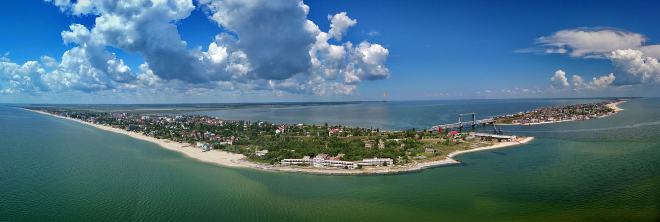
View of the Liman of Dniester from the sea.
In the middle between the sea and Liman lies the village Zatoka with a bridge across the Dniester Strait. In the center, the Akkerman fortress is marked on the horizon.
On the left, the Budziak region (Bessarabia) inhabited by Bulgarians and Gagauzians. On the right, behind the bridge - Karolino-Bugaz and on the horizon - the Nogaj steppes of Yedisan.
These are the historic lands of our ancestors. Poles live in Odessa and the surrounding area to this day, preserving their language and faith.
Julian Ursyn Niemcewicz described "A journey through Volhynia, Podolia up to Odessa in 1818" in the work Historical journeys across Polish lands between 1811 and 1828.
In the OSSOLINEUM library in Wrocław there is a book "Memories of Odessa, Jedisan and Budzak: a diary of a ride in 1843, from June 22 to September 11" by J. I. Kraszewski, which also describes the life of Poles in these areas.
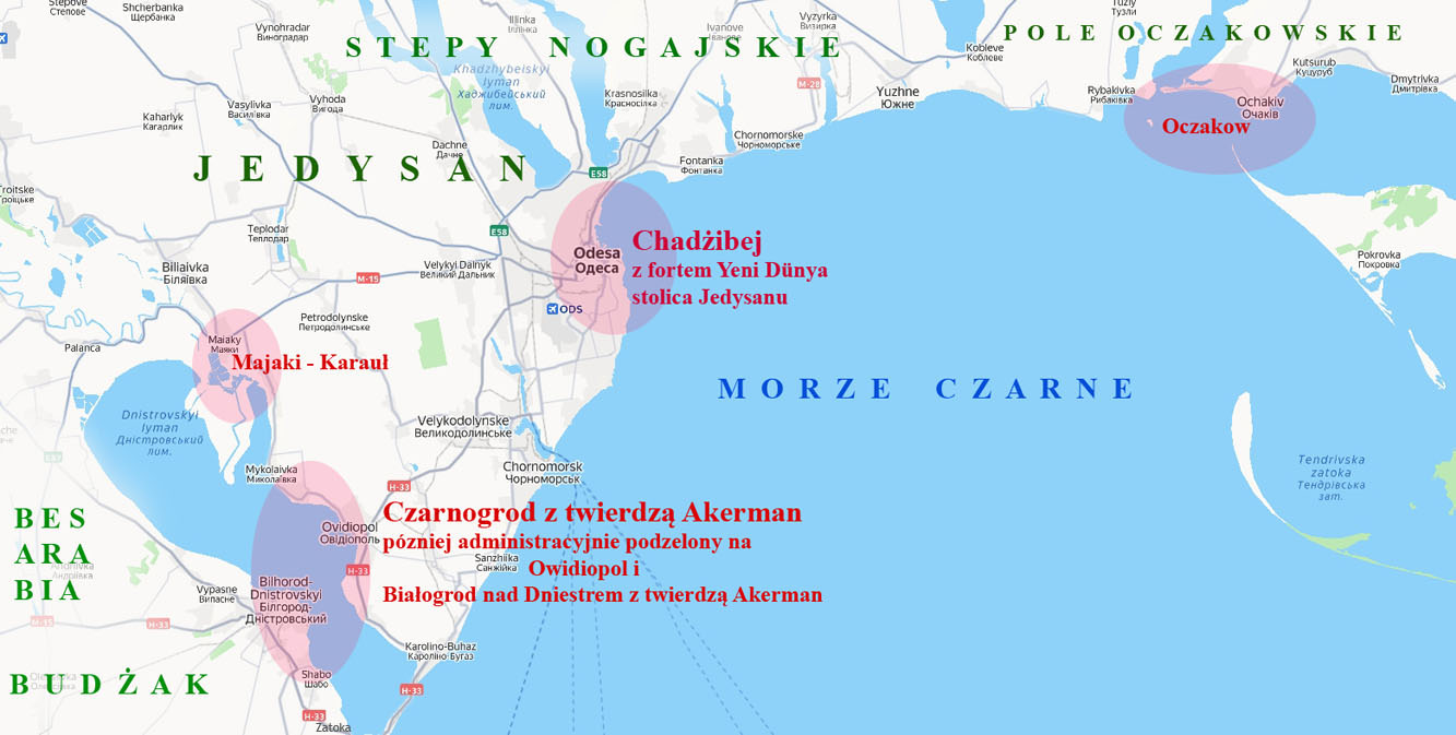
Coastal areas of the Polish-Lithuanian
Commonwealth.
Map of the main cities, ports and fortifications of Yedisan on the
Black Sea coast in the 14th-16th centuries.
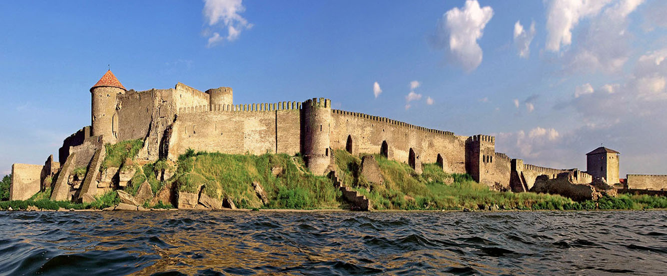
Białogrod on the Dniester. View of the Akkerman Fortress from the Liman side.
The sons of Michał Awdaniec (Generation 0), an associate of Prince Władysław of Opole, Michał, Michał Mużyło, and Teodoryk Buczacki (Generation 1), in the years 1410-1460 were key figures in the Russian policy of three subsequent monarchs: Władysław Jagiełło, Władysław Warneńczyk and Casimir Jagiellończyk.
The size of the latifundium that Michał Abdańczyk of Buczacz began to create in the years 1372-1410 in the area of Podolia, Poberezhe (Bracław Voivodeship) and Yedisan (Field of Ochakow) in the 1450s was enormous.
These areas connected Poland and Lithuania with the Black Sea with a wide strip between the Dniester and Southern Bug rivers (about 100 x 500 km) between Moldova and Bessarabia and Moskovia and the Tatar Khanate.
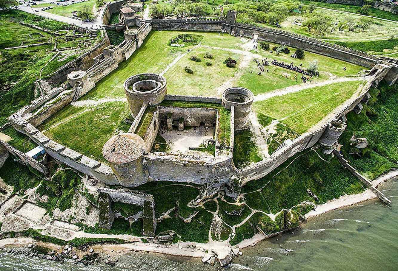
Akkerman Fortress from a bird's eye view.
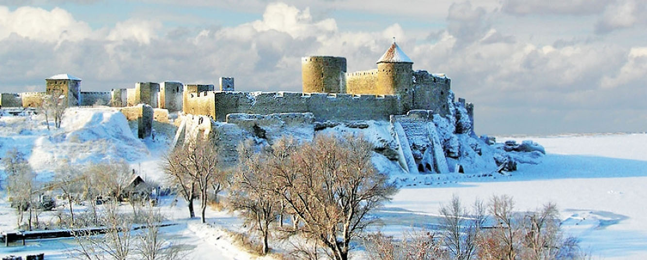
Winter on the Dniester Liman.
The Buczacki clan had key offices on the border of the Crown in Kamieniec, Czerwonogród, Śniatyń, Halicz... and connected them with the offices of voivodes and castellans.
The family from Buczacz controlled transit trade routes, salt production, give to pledg goods received from the king, had the right to collect tolls, control forest clearing, etc.
Water routes, including those on the Dniester, and land routes east of the Dniester River, were particularly important and were of strategic importance for Poland and Lithuania in trade with countries located on the Black and Mediterranean Seas.
In fact, it was a section of the trans-European trade route connecting the Baltic and Black Sea ports.
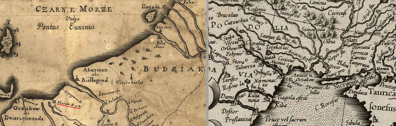
Polish
map of Budziak and Yedisan
(Field
of
Ochakov)
in the years 1490 - 1500
rotated 180 degrees - view of the sea from the shore
and Mercator's map of the territory of Polish Podolia on the Black Sea.
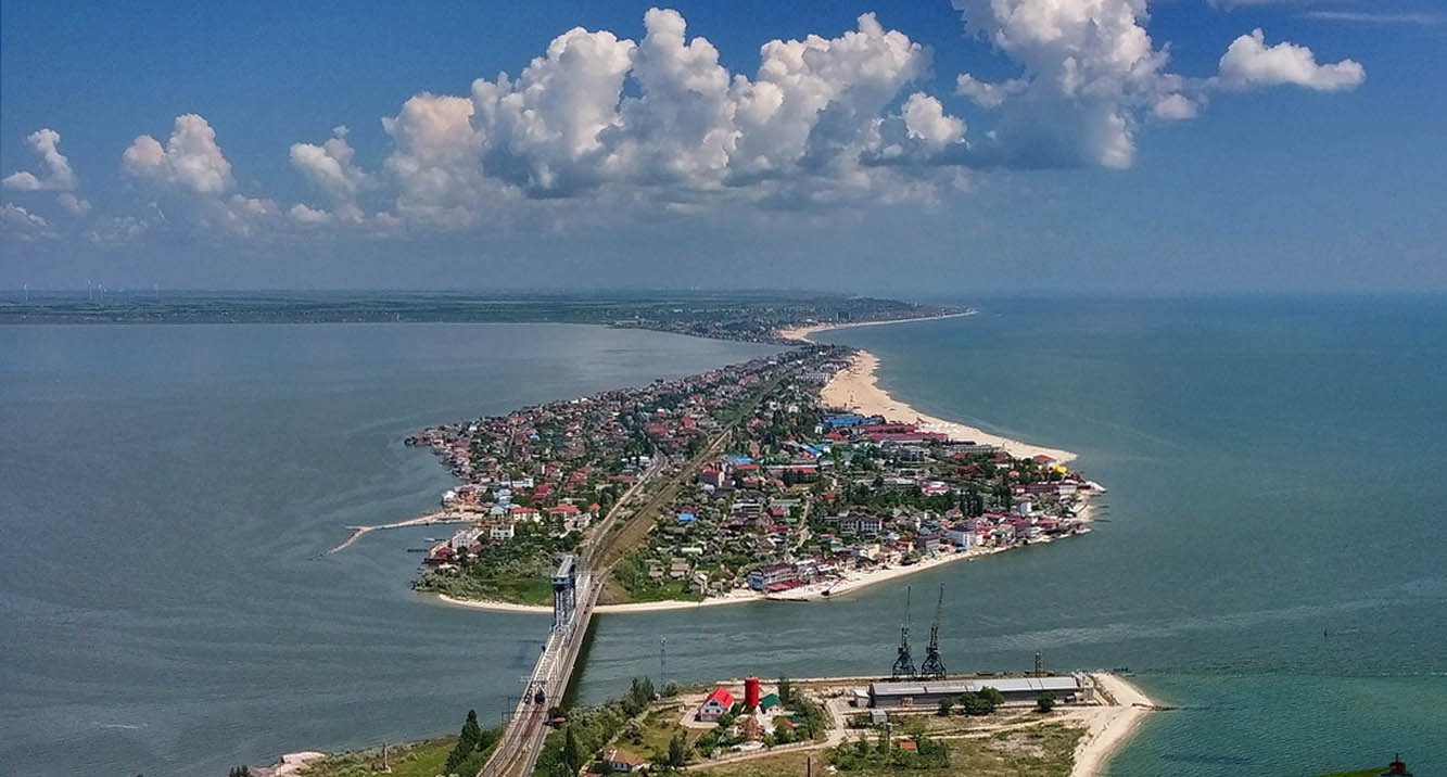
The
Dniester Liman Strait and the town of Karolino-Bugaz on the
spit.
Liman on the left, sea - on the right.
On the horizon, 30 km away, you can see the port city of Chornomorsk, and even further, 10 km beyond the horizon, the city of Odessa begins.
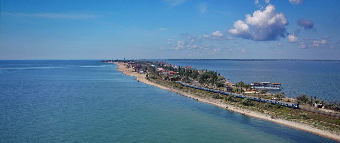
Dniester Liman Spit (Carolino-Bugaz). Favorite place to relax.
The sea
for salt water lovers on the left side of the spit. Liman with fresh
water - on the right, here you can also wash off the salt after
swimming in the sea.
The Odessa - Belogrod on the Dniester
train runs through Karolino-Bugaz and Zatoka, and after 500 years,
only this has changed.
***
The Crown's involvement in Moldavian and Tatar affairs resulted in the entry of "the sum of three thousand fines in Polish coins on the cities on the Black Sea." This concerned in particular:
Czarnogrod (now Belgorod with the Akkerman fortress on the western bank of the Liman Dniester and Ovidiopol on the eastern bank),
Khajibey (the port and city of Khaji-Bey on the spit of the Khadjibey and Kuyalnik limans, now Odessa),
Ochakov (fortress on the cape of the Dnieper Bay for the control of navigation on the Dnieper and Boh rivers),
Karauł - a fortress at the mouth of the Dniester to control traffic on the river also between the right and left banks, currently Majaki from the name of the village of Mayak-Karauł (Lighthouse-Guard).
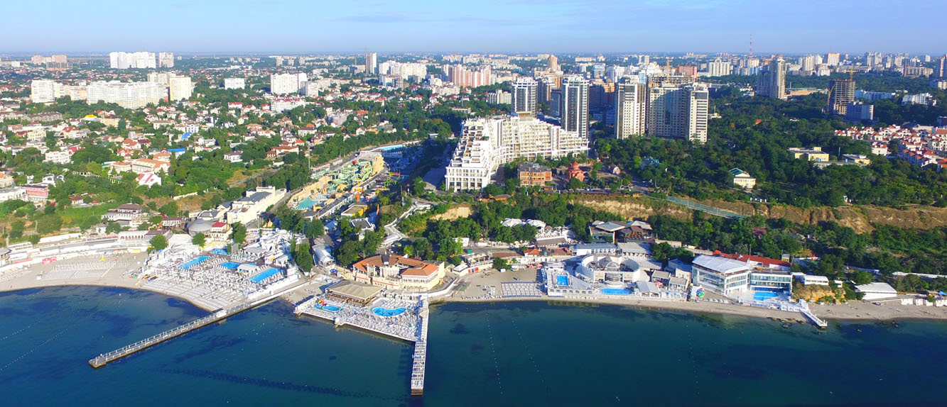
Odessa,
Arcadia beach.
Before 1960, it was a suburban resort which can
still be reached by tram No. 5 from Langeron
via the French boulevard.
The shore of Arcadia is a place
where
there are two reliefs, typical of the northern coastline.
Sandy
beaches from twenty meters wide, right next to the water, occur along
the entire coastline from west to east, stone shores are very
rare.
At the mouth of dried rivers or limans, as on the left
side of the photo, there is a flat sandy shore or spit.
The
second type of relief is visible on
the right: above the beach there
is a clay escarpment about 50 meters high and beyond there is a flat
steppe. Sometimes, under the clay layer, there is a stone - shell
limestone.
To the north, the earth's surface slowly rises to 100
meters above sea level.
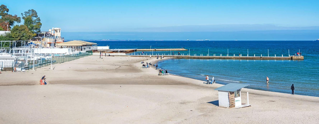
The oldest beach on Cape Langeron in the center of Odessa, late August.
Paradoxically, the climate at the seaside is very dry, the sky can be cloudless for several months. Autumn for the few trees growing close to water in the river valleys began already in September.
The Yedisan steppes were devoid of forests, only steppe grasses grew, green from April to July and for one month in autumn.
The only materials available
to the builders were sand, clay and hay or straw.
Even
as I remember it,
in the years 1960-1965, people in the villages lived in clay houses
without floors and with a straw roof.
The lack of wood for building houses, ports and ships, as well as the lack of hard stone for hardening land roads, forced construction materials to be delivered by sea by ships from Greece and Anatolia.
All this required huge investment funds to strengthen the borderland's defense.
* * *
The amount of financial turnover of the Buczacki family, as large as the budget of a country such as Moldova, aroused envy and suspicions of possible financial frauds.
"The nobility and the king were fed up with the growing power of the Buczacz family on the eastern border of the Polish Crown"
* * *The revision of the letters regarding the right to own property lasted from December 4, 1563 to March 21, 1564 in the Ruthenian lands of the Crown.
Jerzy Jazłowiecki Buczacki (1510-1575) presented the entire file for the possession of 10 villages in various Podolia Voivodeship, the right to lease the castle and the city of Chervonogród, and finally he presented the old sums that had been due since 1442 to the cities on the Black Sea coast as a financial debt of the treasury to the heirs of Theodoric Buczacki.
The rest of the Buczacki Jazłowiecki estate was located in the territory of the Grand Duchy of Lithuania and could not be enforced.
When submitting the documents, Jerzy Jazłowiecki asked His Majesty for a reward (for the repayment of debts and/or the granting of a title), but Zygmunt August was adamant on this matter: "And as for the merits of Mr. Jasłowiecki's ancestors and himself. I will give about those for another time. - No remuneration!
The reason was simple - the Crown had no cash or other goods for exchange.
The merits of Theodoric and his descendants in expanding and defending the borders of the kingdom were not appreciated for 100 years.
* * *
Katarzyna Buczacka (Generation 3), wife of Jan Tworowski (d. 1547), submitted four packages of privileges to the commissioners.
The
matter seemed a bit complicated because she inherited the property
from her brother, Bishop Jakub
Buczacki of Podhajce,
who died on May 6, 1541.
She had to prove that as the general
heir she was entitled to privileges and a coat of arms.
Katarzyna Buczacka also escaped from this search practically unscathed, only in the village of Biła there was a "bare life sentence", so "You will owe it to His Majesty's treasury."
* * *
Documents presented for the examination were not only from the kings (Władysław II Jagiełło, Władysław III of Poland and Casimir Jagiellończyk) but also letters from princes Bolesław Świdrygiełło and Witold Kiejstutowicz, who, as it turned out, had the same importance for the commissioners as the royal documents.
If the audit detected irregularities, the goods would be returned to royal jurisdiction by imposing a special tax on the Podolia nobility.
* * *
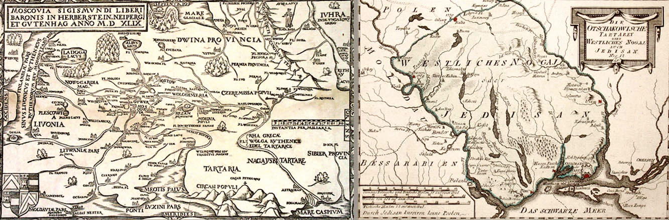
Ochakov on Sigismund von Herberstein's map from 1549 and the German map of Yedisan with the Ochakov Fortress
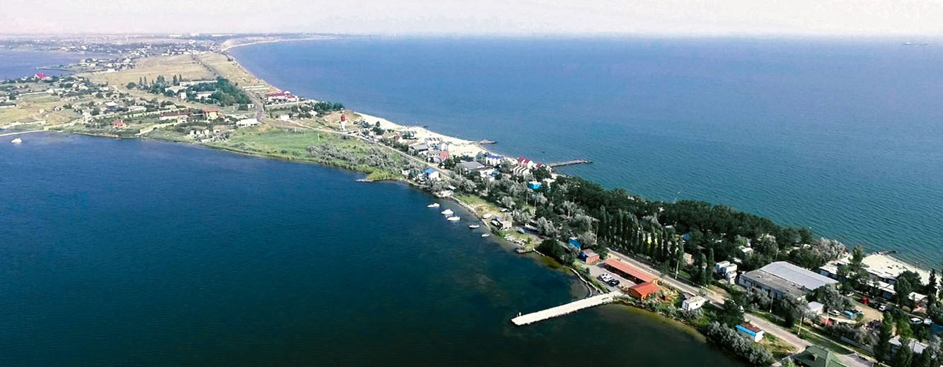
Ochakov. Spit Lagerna Kosa. Left front – Sosycki liman, on the right side – Black Sea
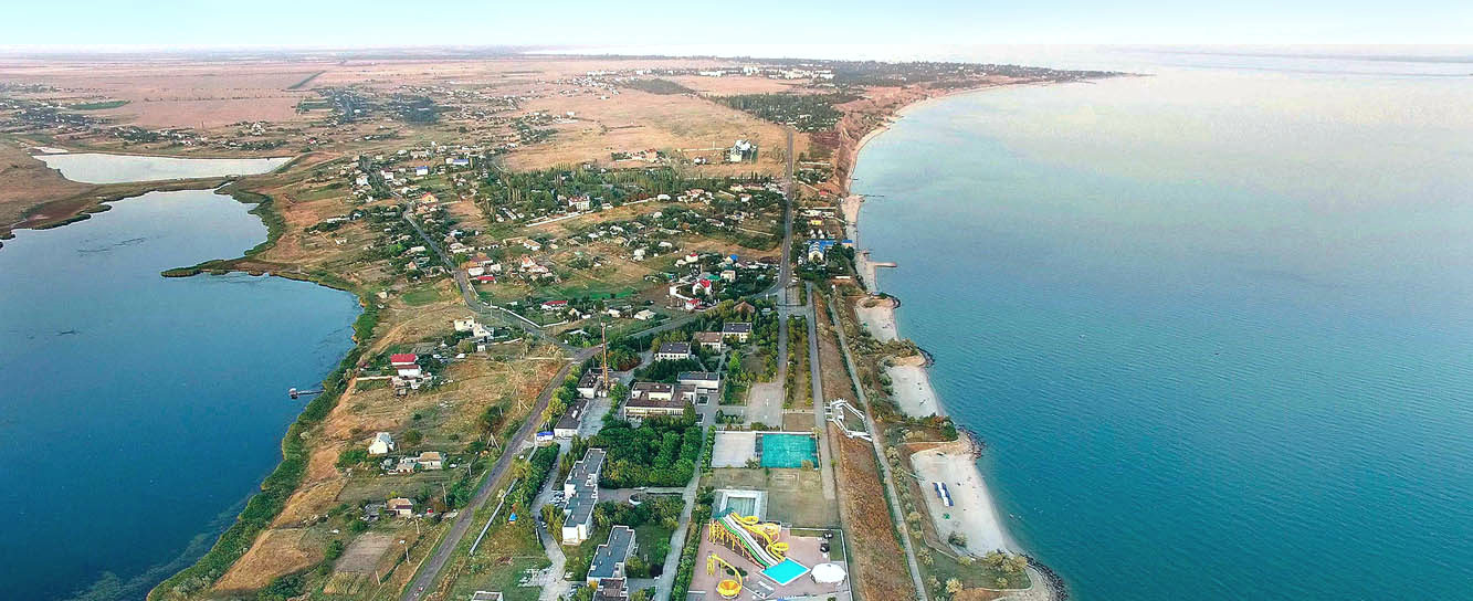
Ochakov. Spit. On the left side, Beykush Bay, on the right side the Black Sea, then Dnieper Bay and the city center on the cape.
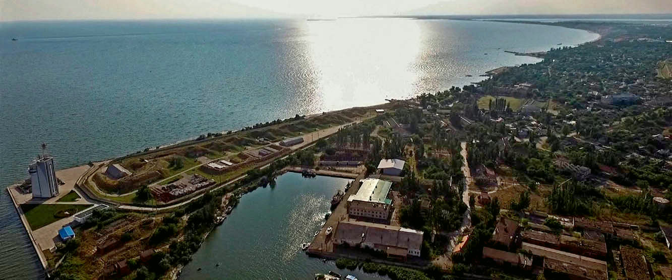
Ochakov. A cape on the Dnieper Bay on which fortresses have been built and demolished many times.
***
The conflict between the king and the nobility of Podolia and the execution of estates from 1564 resulted in reduced trust in the Polish monarchy, the nobility's withdrawal of investments in the construction of facilities to defend the borderlands, and a drastic reduction of the army at the border in the southeast of the kingdom.
Some of the poorest nobility, who were unable to present documents of privileges or property to the king's commissioners, paid homage to the Moldavian hospodar and received fiefs and the title of boyars.
After the Union of Lublin in 1569, mass migration from Poland began.
* * *
With the death of Sigismund I the Old, the validity of the peace treaty signed fifteen years earlier with Sultan Suleiman I the Magnificent expired on April 1, 1548.
Polish-Turkish relations were still excellent, as evidenced by the correspondence between Suleiman I and the young King Sigismund Augustus, in which the Sultan compared them to the friendship between father and son.
As late as 1550, the Grand Dukes of Lithuania and Moscow recognized the imperial status of the Crimean khans and titled them "Crimean Tsars" (or "Perekop Tsars", Caesar Praecopensis) and the conflicts between Poles and Nogai nomads were manageable.
Unfortunately, in 1660, the activation of Russia's expansionist policy on the northern coast of the Black Sea began.
On March 11, 1668, at the general council of the Zaporozhian army near Korsun, "subordination to the Sultan" was officially announced, following the example of the dependence of the ports of Wallachia and Moldavian principalities.
The Zaporozhian military state became part of the Ottoman Empire, and Doroshenko received the title of Bey of the Zaporizhian Sanjak from the Turkish Sultan Mehmed IV.
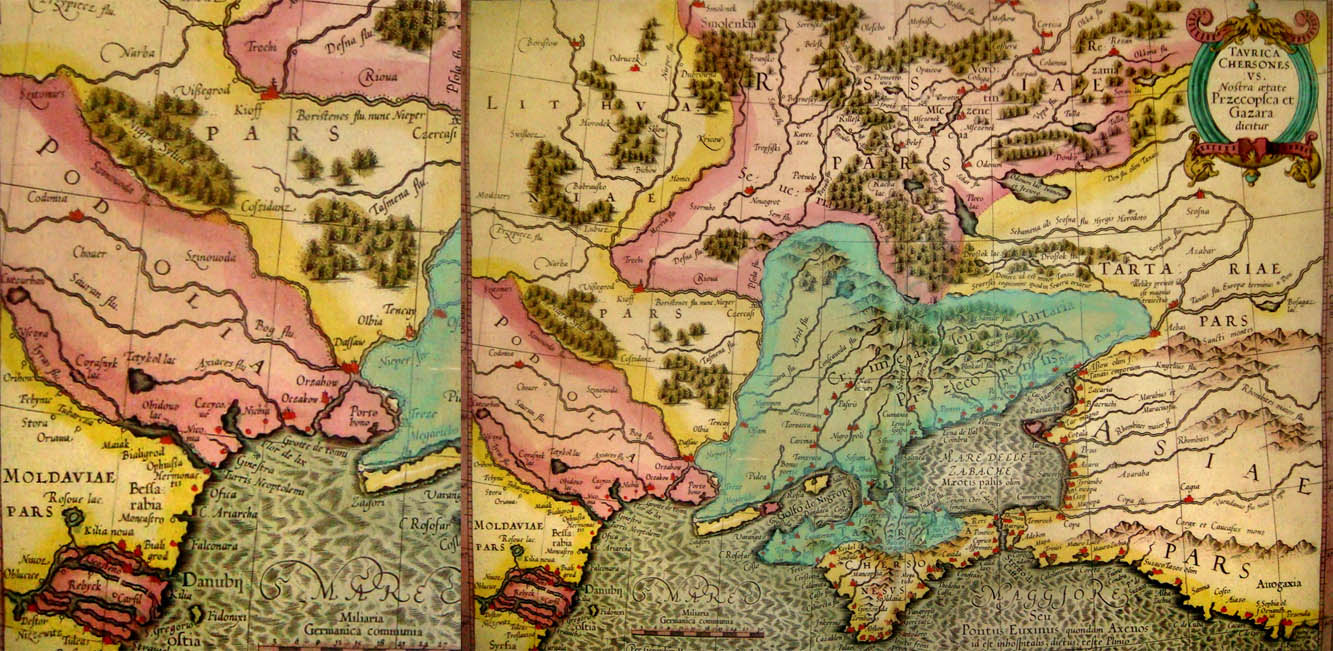
Mercator's "Tavrica Chersones" map from 1613, one of the last ones before the war of 1962.
Polish Podolia
(painted in pink) reaches
from Moldova beyond Ochakiv to Crimean Tataria.
Lithuania has
already been cut off from the sea by the Tatars, Bessarabia is part
of Moldova.
When Türkiye declared war on the Polish-Lithuanian Commonwealth in January 1672, the Polish-Lithuanian state was plagued by internal unrest, and the escalation of the conflict between the king and the opposition threatened the outbreak of a civil war.
In the summer, Turkish troops under the command of Sultan Mehmed IV entered the borders of the Polish-Lithuanian Commonwealth. After a short siege, the strongest fortress in the country - Kamieniec Podolski - surrendered, and the Turkish army moved towards Lvov and Zamość.
In this situation, King Michał Korybut Wiśniowiecki decided to start talks with the invader. Their effect was the signing of the Buczacz agreement, in which the Polish-Lithuanian Commonwealth ceded to Turkey, among others, Podolia, Pobereże and Yedisan, and undertook to pay an annual tribute of 22,000 ducats.
The nobility passed special taxes for the war at the Sejm and rejected the ratification of the shameful treaty, which was tantamount to rejecting any form of submission to Turkey.
In 1673, John Sobieski won a great victory over the Turks at Chocim. Despite this, Podolia returned to the Polish-Lithuanian Commonwealth only in 1699 as a result of the provisions of the Peace Treaty of Karłowice.
However, Poland did not regain the territories of Yedisan and in fact remained cut off from the sea ports in the south.
* * *
After the border changes, most of the Polish population remained to live and run their farms in the vast steppes of the Nogai nomads.
After the first migration in 1569 and the second mass migration after 1780, the Polish diaspora increased many times and the settlement areas reached Crimea.
Poland returned to Yedisan (Ochakowski Field) on the Black Sea only after 1792, when the Polish state was annexed to Russia as a Kingdom within the Empire.
State borders have been changed many times over time, but Poles, like nation, have lived in coastal areas "forever and ever" and the language, faith and different alphabet have helped preserve their identity for centuries.
* * *
*Sources: Buczacki
family archive, stories and memories of family members,
state
archives, open sources of information.
*Images and texts may be protected by copyright.
"HISTORY OF THE BUCZACCY FAMILY" "RETURN TO THE BLACK SEA" "POLES IN ODESSA"
"BUCZACCY" - PORTAL HOME PAGE
License: © All rights reserved by Serg Buczacki